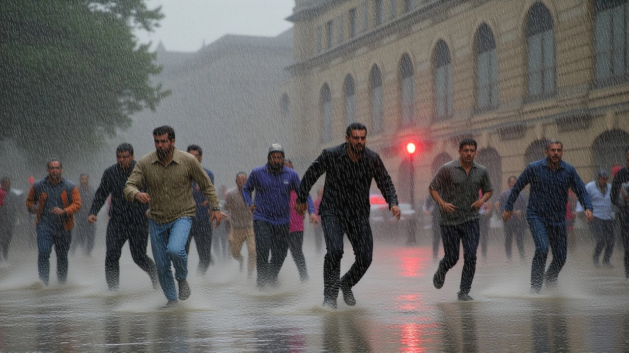
When India Meteorological Department (IMD) issued a massive weather alert on June 17, it wasn't just another forecast—it was a wake-up call for millions. The agency warned of heavy rain, thunderstorms, and lightning across 21 states, including the National Capital Region. Here’s the thing: this isn’t isolated chaos. It’s a clash between an active western disturbance and the advancing southwest monsoon, creating a volatile mix that has left cities from Delhi to Bihar bracing for impact.
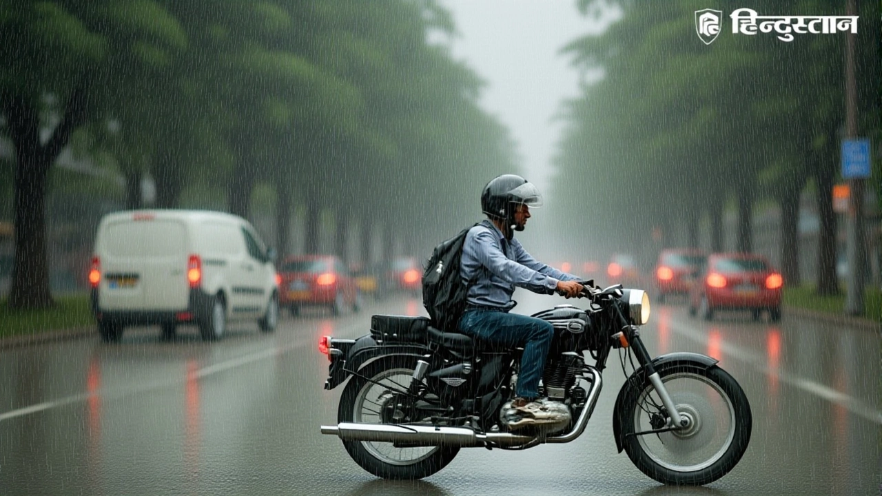
The alert covers a staggering geographic spread. From the urban sprawl of New Delhi to the agricultural heartlands of Uttar Pradesh and Bihar, residents are facing wind gusts reaching 80–90 km/h. In some areas, dust storms and hail have been reported, complicating travel and threatening infrastructure. For those stuck indoors watching the sky darken, the immediate concern is safety—but the broader implications ripple through agriculture, power grids, and daily commutes.
The Meteorological Clash
Turns out, the culprit behind this widespread disruption is a classic meteorological showdown. An active western disturbance—typically associated with winter rains in northern India—is colliding with the southwest monsoon, which is making rapid progress over central and north India. This convergence creates instability in the atmosphere, leading to sudden, intense downpours and squally winds.
According to reports, wind speeds in certain pockets could hit 85 km/h. That’s fast enough to snap tree branches and topple weak structures. In Rajasthan, where such extreme weather is less common, authorities are particularly vigilant. Dust storms, driven by these high-speed winds, have reduced visibility significantly, posing risks for drivers and pedestrians alike.
Regional Breakdown: Who’s Affected?
The impact varies by region, but no one is entirely safe. Let’s break it down:
- Delhi-NCR & UP: Expect light to moderate rain with thunderstorms. Temperatures in Delhi are predicted to drop to a maximum of 36°C and a minimum of 25°C, offering brief relief from the heat. Cities like Meerut, Agra, Kanpur, Prayagraj, Varanasi, and Gorakhpur face alerts for heavy rain and lightning.
- Bihar & Jharkhand: The monsoon front is pushing forward here. Wind speeds of 50–70 km/h are expected, with potential damage to crops in eastern districts. Farmers are advised to secure harvests immediately.
- Himalayan Belt: Uttarakhand and Himachal Pradesh are seeing rain accompanied by hail. Wind speeds in Uttarakhand may reach 70 km/h, disrupting tourism and local transport.
- Northeast & South: While the focus is on the north, states like Arunachal Pradesh, Assam, Meghalaya, and even coastal Karnataka, Kerala, and Tamil Nadu are under watch for heavy to very heavy rainfall.
Why This Matters Beyond the Rain
It’s easy to dismiss weather alerts as background noise until your power goes out or your commute turns into a trek. But this event highlights deeper vulnerabilities. In rural Bihar, where many farmers rely on seasonal timing, unexpected storms can wipe out weeks of labor. In urban centers like Delhi, drainage systems often struggle to cope with sudden deluges, leading to waterlogging and traffic gridlock.
Moreover, the frequency of such extreme events is rising. Climate scientists point to changing atmospheric patterns as a key driver. As Ritu Singh, a news anchor covering the story, noted, “The mood of the weather changes suddenly.” Her observation underscores the unpredictability that modern forecasting struggles to fully capture.
What’s Next? Preparing for the Aftermath
As the storm passes, cleanup will begin. Authorities are urging citizens to avoid unnecessary travel and stay away from tall trees and electric poles. Power companies are on standby to restore supply quickly if lines go down. For travelers, especially in hill stations like Kashmir and Uttarakhand, delays are inevitable. Book flexible tickets and check road conditions before heading out.
In the long term, this event serves as a reminder of the need for better urban planning and climate-resilient infrastructure. Whether it’s upgrading drainage in Mumbai or reinforcing crop insurance schemes in Bihar, adaptation is no longer optional—it’s essential.
Frequently Asked Questions
Which states are under the highest risk?
Uttar Pradesh, Bihar, Delhi, Rajasthan, and parts of the Himalayan belt face the highest risk due to strong winds and lightning. Coastal southern states are also under watch for heavy rainfall.
How long will the bad weather last?
The initial alert covers the next 24 hours, but extended forecasts suggest impacts could linger for up to 72 hours in some regions, particularly in the northeast and south.
Is this related to climate change?
While individual weather events can’t be directly attributed to climate change, experts note that increasing frequency and intensity of such storms align with broader global warming trends.
What should farmers do during this period?
Farmers should secure loose materials, protect standing crops from wind damage, and avoid field work during peak storm hours. Check local advisories for specific guidance.