
When India Meteorological Department (IMD) issued its all-India weather bulletin on May 8, 2026, the message was clear: brace for impact. The agency has placed 11 states under a high-alert status for stormy winds, thunderstorms, and heavy rainfall. For residents in Uttar Pradesh, Bihar, and parts of the Himalayas, this isn't just a cloudy day—it's a potential safety hazard with gusts hitting 55 km/h.
The twist is that while the north and east are getting soaked, the west is baking. It’s a classic pre-monsoon seesaw, where one half of the country deals with flooding risks and the other faces dangerous heatwaves. Here’s what you need to know to stay safe over the next few days.
A Storm Front Sweeps the North and East
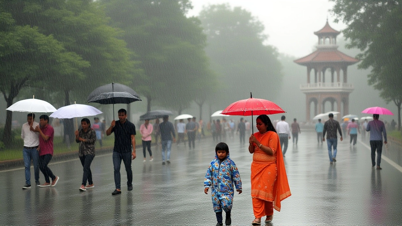
The immediate concern lies in the northern plains. According to reports from Navbharat Times and GNT TV, the IMD has flagged severe weather conditions across Uttar Pradesh, Bihar, Madhya Pradesh, and Rajasthan. But the numbers tell a starker story than just "rain expected."
In Uttar Pradesh, the alert covers May 8 through May 9. Residents in the Tarai region and eastern districts should expect isolated showers accompanied by thunder. More worryingly, dust-laden winds could reach speeds of 40–50 km/h. Farmers working in open fields are particularly at risk here; lightning strikes remain a significant danger during these pre-monsoon storms. By May 9, however, the weather is expected to clear up, returning to dry conditions—a brief respite before the monsoon fully arrives.
Bihar faces a slightly longer ordeal. The alert extends from May 8 to May 11. During this four-day window, winds between 30–50 km/h will accompany thunderstorms. This isn’t a passing shower; it’s a sustained period of unstable weather that could disrupt travel and outdoor activities for much of the week.
Himalayan Hazards: Snow and Strong Gusts
If you’re planning a trip to the mountains, reconsider. The situation in Uttarakhand and Himachal Pradesh is volatile. In Uttarakhand, the IMD predicts wind speeds of 50–60 km/h, with gusts potentially spiking to 70 km/h on May 8. That’s enough to bring down trees and snap power lines.
Districts like Nainital, Chamoli, Rudraprayag, and Pithoragarh are under specific alerts for heavy rain and snowfall. The pattern suggests a three-day window of disruption:
- May 8: Heavy rain and snow alerts for Uttarkashi, Rudraprayag, Chamoli, and Pithoragarh.
- May 9: Conditions shift to Nainital and Almora.
- May 10: The cycle returns to Uttarkashi, Rudraprayag, and Chamoli.
This continuous cycle means mountain roads may face landslides or closures. Travelers should check local transport updates before heading out. Meanwhile, Himachal Pradesh sees its own bout of bad weather on May 11–12, with thunderstorms and winds of 40–50 km/h threatening hill stations.

The Heatwave Hits the West
While the north sweats through humidity and rain, the west is dealing with pure heat. A severe heatwave warning is active from May 8 to May 12. Temperatures in affected areas could rise by 2–3°C above normal, pushing highs past 40°C. Loo (hot, dry winds) are expected during afternoon hours, posing serious health risks, especially for the elderly and those working outdoors.
Gujarat and western Rajasthan are in the crosshairs. From May 9 to May 13, these regions will experience intense heat. It’s a stark contrast to the relief rain elsewhere. Health departments are likely advising citizens to stay hydrated and avoid midday sun exposure.
Even Delhi-NCR isn't immune to the warmth, though it’s not yet in the "severe" category. On May 8, the maximum temperature is estimated at 37°C with a minimum of 23°C. It’s hot, but manageable compared to the west. However, keep an eye on the forecast: another round of rain and thunderstorms is predicted for Delhi, Punjab, Haryana, and western UP from May 11 to May 13.
Southern India: Pre-Monsoon Showers
Don’t think the south is off the hook. Tamil Nadu, Kerala, Karnataka, Telangana, Andhra Pradesh, and Puducherry are seeing continued pre-monsoon activity. The IMD has issued heavy rain warnings for Tamil Nadu, Puducherry, and Kerala. South Interior Karnataka is also expecting heavy rainfall on May 8.
These aren’t just gentle drizzles; they’re convective showers driven by local heating. While they provide some relief from the summer heat, they can cause waterlogging in urban areas like Chennai and Bengaluru. Drivers should exercise caution during peak hours.
What Experts Are Saying
Weather analysts point out that this dual-pattern—stormy north/west and hot west—is typical for early May. The jet stream shifts, creating instability in the north while high-pressure systems bake the west. The key takeaway? Volatility. As Gaon Connection noted, "The weather has taken a sudden turn."
The discrepancy in reporting dates—some sources saying dry weather returns to UP on May 8, others on May 9—highlights the fluid nature of short-term forecasts. Always check the latest IMD bulletins rather than relying on static news headlines.
Frequently Asked Questions
Which states are under the highest weather alert on May 8, 2026?
Eleven states are under alert, including Uttar Pradesh, Bihar, Madhya Pradesh, Rajasthan, Uttarakhand, Himachal Pradesh, Assam, Meghalaya, Arunachal Pradesh, Sikkim, Jharkhand, and Odisha. These regions face risks of thunderstorms, high winds, and heavy rain.
How fast are the winds expected to blow in Uttarakhand?
Wind speeds in Uttarakhand are predicted to reach 50–60 km/h, with gusts potentially hitting 70 km/h on May 8. This poses a risk to infrastructure and travel in hilly districts like Chamoli and Rudraprayag.
Is there a heatwave warning for any part of India?
Yes, a severe heatwave warning is in effect from May 8 to May 12. Gujarat and western Rajasthan are particularly vulnerable, with temperatures rising 2–3°C above normal and potentially exceeding 40°C.
When will the weather clear up in Uttar Pradesh?
Most districts in Uttar Pradesh are expected to see dry and clear skies after May 9. However, a new system may bring rain and thunderstorms back to the region from May 11 to May 13.
What should farmers do during this weather alert?
Farmers are advised to avoid open fields during peak storm hours due to lightning risks. Securing loose structures and checking drainage systems around crops can help mitigate damage from sudden heavy rains and strong winds.